Burma: New Satellite Images Confirm Mass Destruction
"The shocking images of destruction in Burma and burgeoning refugee camps in Bangladesh are two sides of the same coin of human misery being inflicted on the Rohingya." - Phil Robertson, Deputy Asia Director, HRW
“These latest satellite images show why over half a million Rohingya fled to Bangladesh in just four weeks,” said Phil Robertson, deputy Asia director. “The Burmese military destroyed hundreds of Rohingya villages while committing killings, rapes, and other crimes against humanity that forced Rohingya to flee for their lives.”
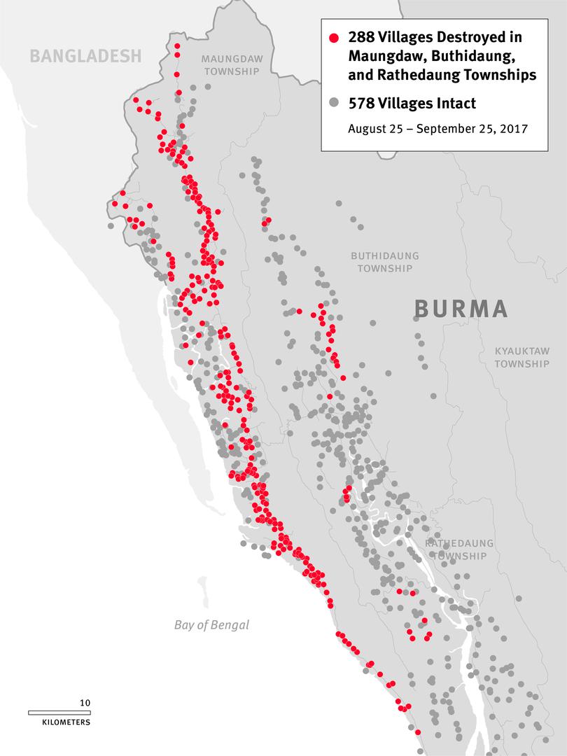
A total of 866 villages in Maungdaw, Rathedaung, and Buthidaung townships in Rakhine State were monitored and analyzed by Human Rights Watch. The most damage occurred in Maungdaw Township, accounting for approximately 90 percent of the areas where destruction happened between August 25 and September 25. Approximately 62 percent of all villages in the township were either partially or completely destroyed, and southern areas of the township were particularly hard hit, with approximately 90 percent of the villages devastated. In many places, satellite imagery showed multiple areas on fire, burning simultaneously over wide areas for extended periods.
Human Rights Watch found that the damage patterns are consistent with fire. Comparing recent imagery with those taken prior to the date of the attacks, analysis showed that most of the damaged villages were 90 to 100 percent destroyed. Many villages which had both Rohingya and Rakhine residing in segregated communities, such as Inn Din and Ywet Hnyo Taung, suffered heavy arson damage from arson attacks, with known Rohingya areas burned to the ground while known Rakhine areas were left intact.
Comments
Post a Comment